

|
|
Natsunoya Tea House
Natsunoya Tea House - Hickam Field
Takeo Yoshikawa was the Japanese spy who used Natsunoya Tea House as one of his locations.
In 1941 this Tea House was known as Shinchoro and the owner was Shuuji Fujiwara. His son
The first photo is an easy one to find on the internet. This was our lunch stop on Tuesday
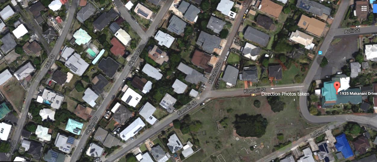
The first of three images utilizing Google maps shows the direction that the pictures were
A friend sent me photos from the late 1930s or early 40s that show this to be what you might
The main difficulty of moving 60 degrees right while at street level is that you see a house
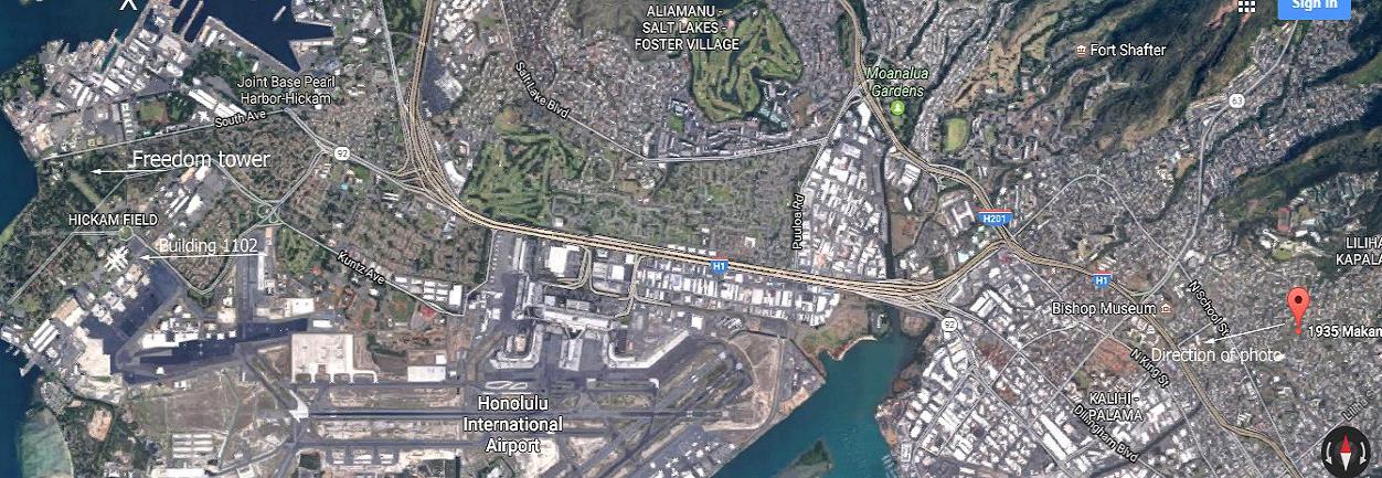
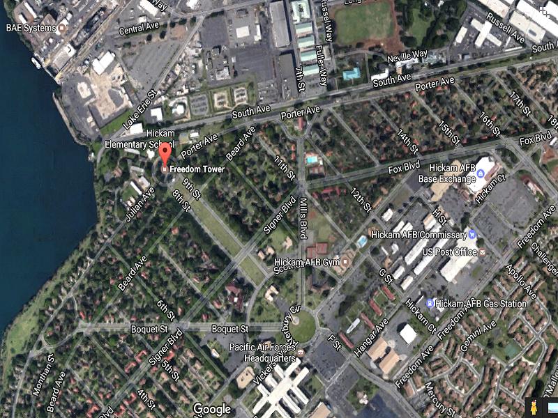
The second Google map shows a larger area with the arrow pointing towards Honolulu
Also on this map are locations of Freedom Tower and a large white building (1102) on
The third Google map has a closer view of where Freedom Tower and Building 1102
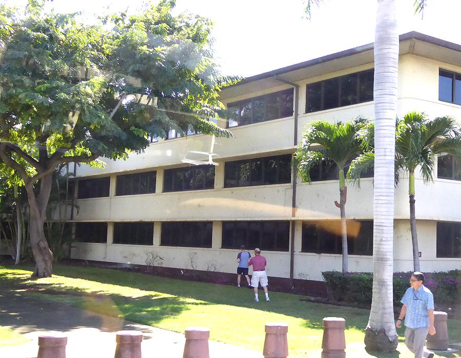
In the three of the photos of Building 1102 you can see bullet holes made by attacking Building 1102 started as a barracks and is now designated as PACAF HQ.
Doug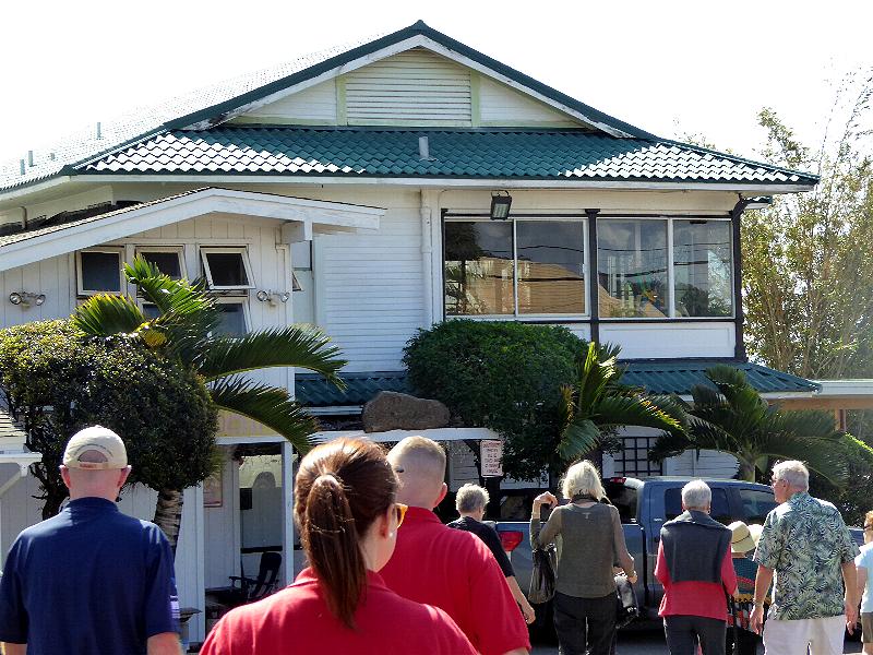
Front of Natsunoya Tea House
The owners knew that he was on the 2nd floor and making use of a telescope that was up there
but were not aware of his purpose.
Laurence Fujiwara, Sr., took over the business in 1958 and changed the name to Natsunoya.
6 December 2016 following the ceremony at Ewa Field. We were in a large room on the
first floor large enough to seat everyone on our tour plus staff. While I did get a glimpse
of a telescope on the second floor, failed to go up to see what the view would like.
taken across the street from the Tea House looking down Kamalii Street. You will notice
the numerous houses in the area.
call a remote location. He also pointed out that my aim should have been 60 degrees to the
right. A line running from the Tea House to just south of the grounds of Trippler Army
Medical Center will end on or close to Ford Island.
instead of wide open spaces.
International Airport. Between distance and eyesight not being perfect, it was not until
returning home and looking at these pictures on a 24 inch monitor that I realized my error.
This is not Ford Island.
Hickam Field. The tower was built in 1938 and stands 171 feet high. Its purpose is to hold
500,000 gallons of water and currently is the tallest Christmas tree in Honolulu.
are located. These photos were taken on Monday 5 Dec 2016 following our visits to
Schofield Barracks and Wheeler Field. We were on the way to lunch at Sam Choy's
restaurant and then to a guided tour at the DPAA facility.
Japanese aircraft. This was a major target and details can be found in the brief history
of this building.
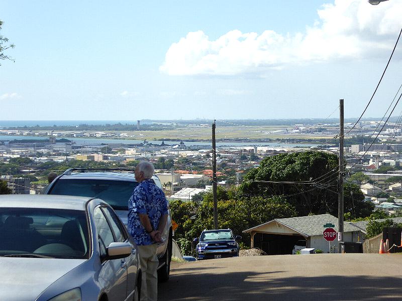
Honolulu Airport from Tea House
Freedom Tower
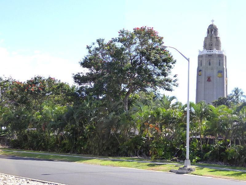
Freedom Tower
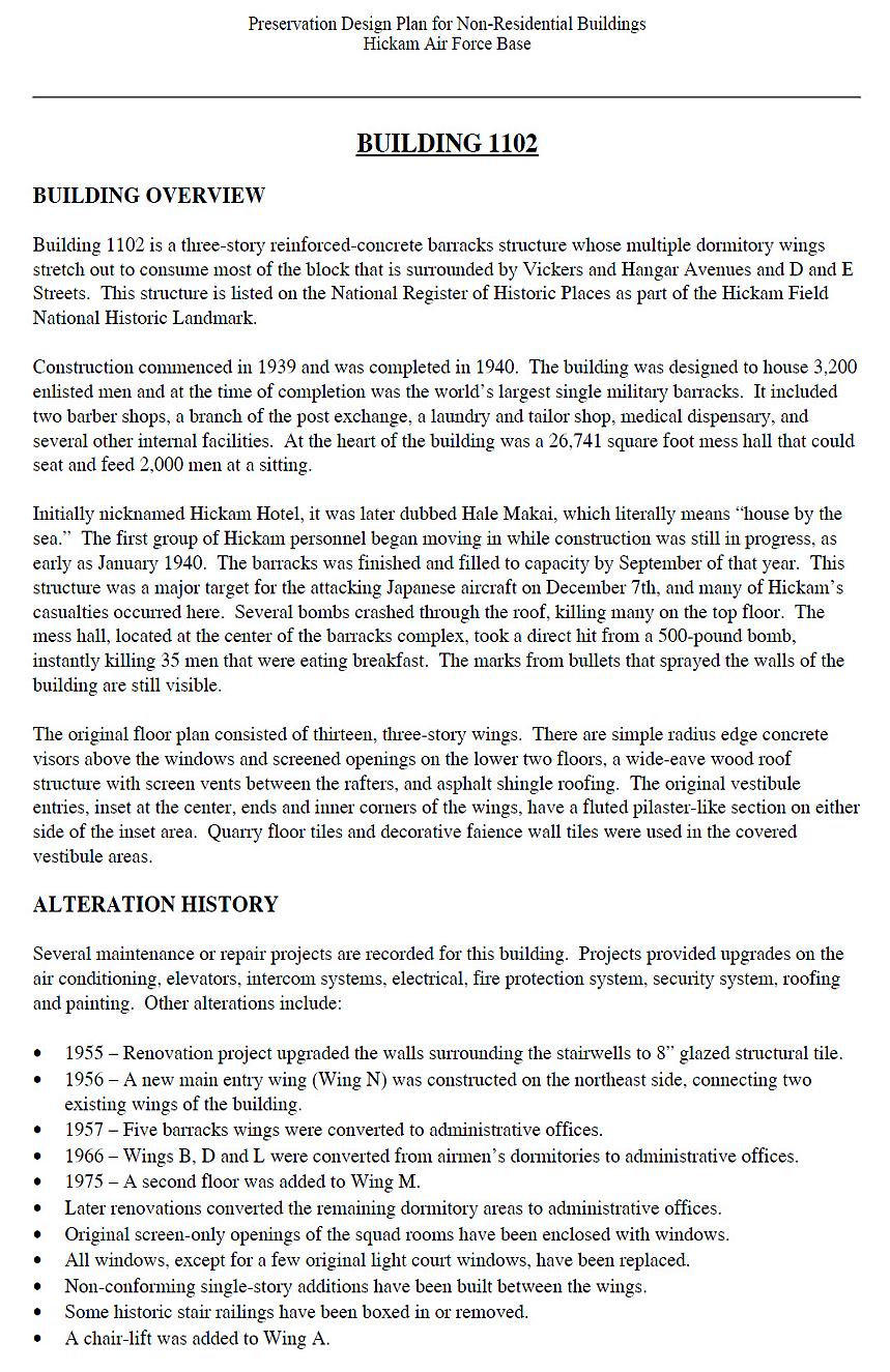
Building 1102 history
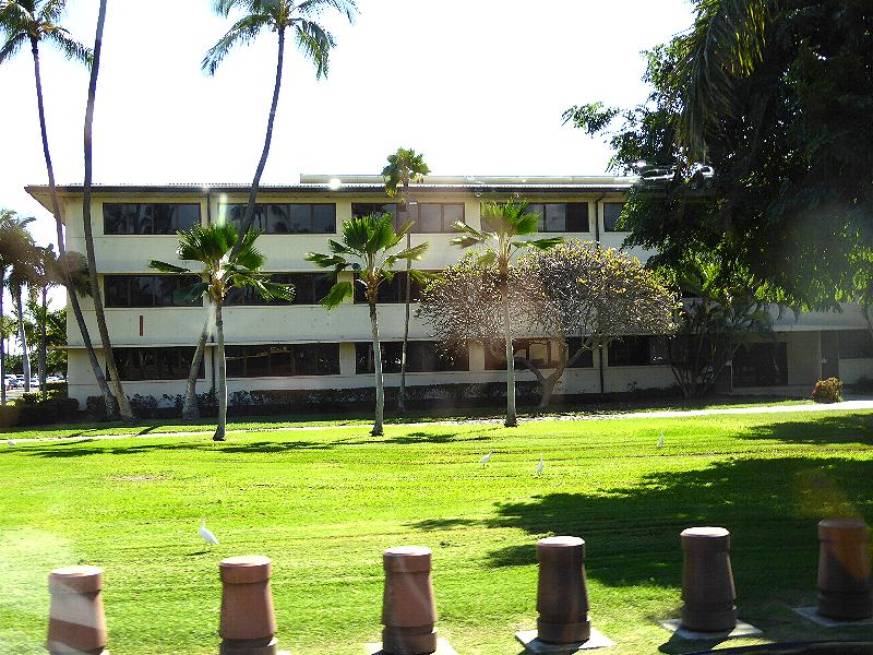
Building 1102-I Wing
Closeup-- Bullet Holes in building 1102
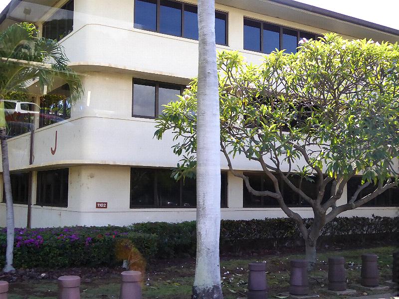
Building 1102-J Wing